Finalist 2022

Aurecon Inground

Aurecon Computational Design Network & Geospatial Teams

Aurecon Inground is a web-based platform that facilitates the creation of data-rich 3D existing utility models on major infrastructure projects.

Aurecon Inground is a web-based platform that facilitates the creation of data-rich 3D utility models for use across major infrastructure and land development projects. Personnel gather existing utility information from multiple sources. This data is formatted and stored in a central geodatabase, from which our Inground tool generates a fully attributed 3D utilities model, suitable for project use. Inground streamlines modelling and attributing utility data, aligns data processes with Australian standards, and provides data quality transparency. The platform enables design and interface coordination to occur earlier in the design process by including defined tolerance zones that identify areas for investigation.

Design Brief:

On transport and other infrastructure projects, existing utility information is used by designers to identify the critical inground infrastructure in urban environments. This information comes from disconnected sources such as utility providers, councils, and surveyors. It is often in 2D mixed formats, meaning assumptions are made about exact location and depth, reducing the information’s accuracy and reliability.

The brief requested a geospatial and computational solution that could improve the reliability of this data. Inground needed to generate 3D models of existing utility models from a geospatial database, communicate the key tolerances and assumptions, and enable collaboration across teams. To deliver a flexible solution, the brief stipulated independence from proprietary 3D modelling engines, while producing assets in neutral formats that would integrate across multiple modelling environments. The achievement is a tool that streamlines and converts these mixed information sources into consistent 3D data, greatly improving information accuracy, reliability, and utilities planning.


This project was developed by:

  • Designed by Aurecon Computational Design Network & Geospatial Teams
  • Designed by Nick Williams, Andrew Macdonald, Richard Syme, Nathan Lawrence, Chris Welch, Rebecca Strang, Tiaan Nel (Aurecon)

Design Process

Aurecon’s Computational Design (CoDe) team worked with utilities experts on the design of this service over multiple phases. As a first line, CoDe team members embedded in the project teams delivering major transport infrastructure across Victoria. Several related but bespoke tools and workflows were prototyped for individual projects and needs. With proven value and insights delivered through these prototypes, a brief for a robust application was developed, with leadership from utilities experts. We then developed the final application, using a core software methodology with iterative testing and feedback from key stakeholders.

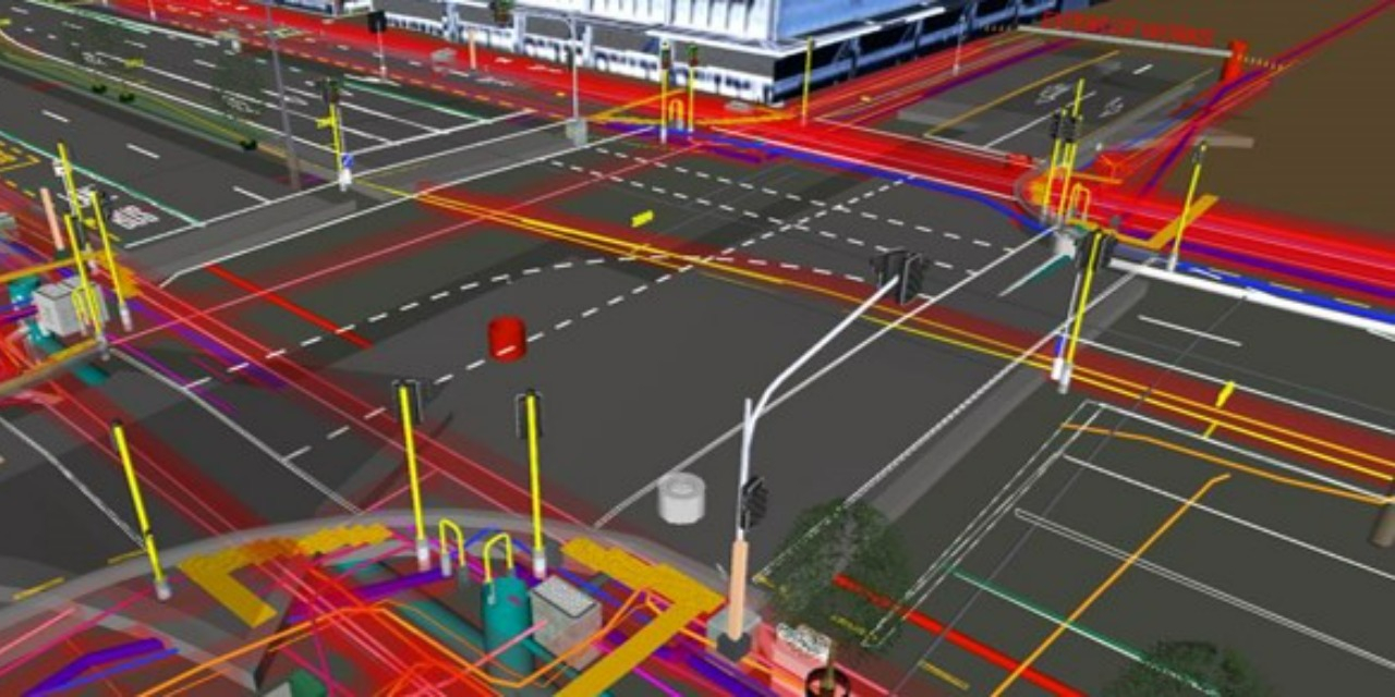
The tool was conceived to solve the specific but recurring issue in transportation design of existing utility locations. Existing utilities pose potentially high risk to design and construction – hitting hidden utilities can result in utility damage (e.g., burst water main), project delays, community disruption, and millions of dollars cost to the project. However, through implementation, it became obvious the tool was applicable to other markets such as land development and water, exceeding the original goal of the design brief.

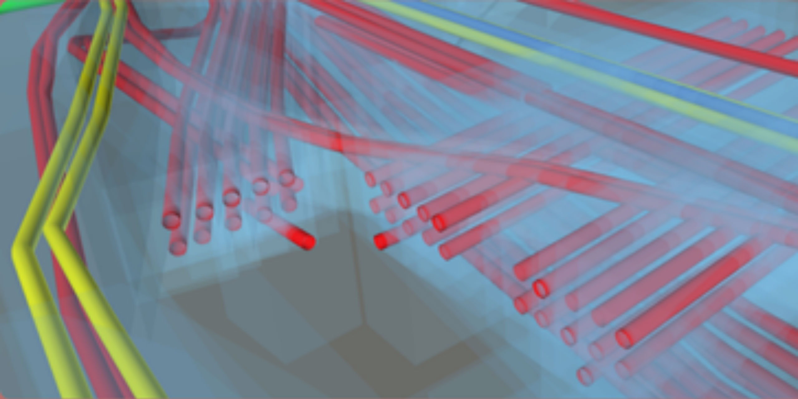
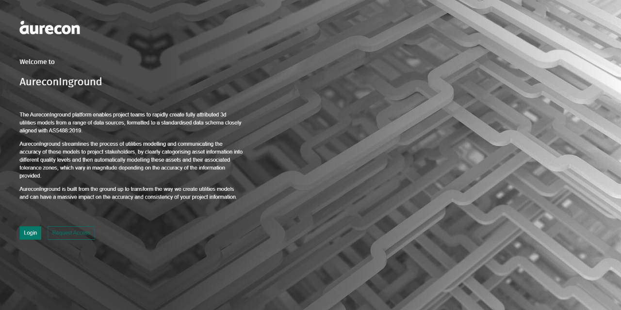
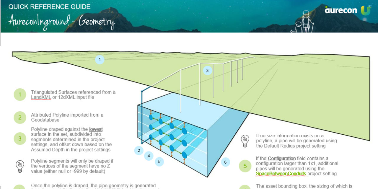
Furthermore, it was evident the increased reliability from standardised data has multiple applications in construction set-out and subsequently in reducing site investigations through operation.  The tooling and data-standard was implemented as a simple web-based application. Secured by a standard authentication service (Microsoft AD), users can log in to access and upload key data, and rapidly generate model outputs as they are needed. Across the first quarter of its implementation, the application has been used on over 60 projects across the business. Uptake is continually supported by on-demand training, reference guides, and a network of product champions.

Design Excellence

Inground demonstrates exemplar design through fit-for-purpose functionality and accessibility. The application significantly improves the quality and access of utilities data, enhancing reliability, efficiency, and accuracy for the designers and engineers who deliver infrastructure projects. User experience is at the core of Inground’s design. Accessibility is supplied to a wide spectrum of users, regardless of their expertise level, through a web tool with neutral file outputs. Users can create and populate projects, add collaborators, and use an interface aesthetically consistent with other Aurecon products.

An entire utilities model can be created in half a minute, ensuring even entry-level staff can generate models. Plus, the entire project history is auditable, with every modification visible to stakeholders. Inground also improves safety through mitigating and reducing the risk of utility clashes (i.e., the danger posed by striking underground high-voltage utilities) and significantly minimises the need for site visits, improving sustainability. The platform takes categorised asset information matching Australian Standard AS5488 and automatically models and attributes these assets and their tolerance zones. This ensures all information related to the team’s understanding of the project is attached to the asset, which lowers the risk of information loss downstream.

An inhouse geometry kernel was also developed to ensure Inground remains standalone, so the platform operates in any context and is not reliant on external CAD packages. Because of this design, users don’t need CAD experience or access to produce a fully attributed 3D model, whether in DXF, LandXML, or 12DXML formats.  Inground sets a new benchmark for design excellence in Victoria by introducing a discrete data standard to consistently capture data. While AS5488 sets out information grades, currently there is no matching data standard. We have created such a standard for this service, drastically reducing the time it takes to create interoperable 3D models.

Design Innovation

Civil and building design has long navigated and needed to work around poor-quality information on underground utilities, a significant design problem with potential and realised high consequence. Inground exemplifies how computational design and geospatial methodologies can result in innovative solutions to engineering problems, by streamlining data from mixed sources. While geospatial databases are commonly used, they are usually restricted to technical users. But through Inground’s user-centred design and accessibility, the tool is available to a wide spectrum of stakeholders.

The design does not require a high level of technical expertise from the user to extract value from the tool. The design aimed to empower users with confidence and flexibility using the platform, in many ways. That’s why users can create projects, generate models, add collaborators, see modifications, update project settings, upload surface files, run a job, manage their own personal profiles, and populate projects with default settings for conversion. It is accessible to personnel of all experience levels and uses an inhouse geometry kernel, so CAD expertise is not required. Further, Inground connects to other Aurecon APIs, so in future, user permissions can be supplied for other project teams to access Inground. The app’s Quick Reference Guide also clearly and explicitly lays out usage instructions, troubleshooting, FAQ, and contacts for further support.

Design Impact

The architecture, engineering, and construction (AEC) industry is transitioning from discrete desktop-based software tools to web-based platforms with connected datasets. With these platforms come opportunities to streamline and automate processes, which improves accessibility and reliability of data. The immediate opportunity and realised benefits of these automated systems is in the greater efficiency of project teams. Not only are key tasks quicker, but experts are able to redirect time previously spent on relating fragmented datasets, to other critical design activities. Unreliable utility information increases project risk in various areas. This starts with commercial risks (project delays and cost overruns due to damaged services) and extends to risks to people & property.

On infrastructure projects, reliable, accurate information about underground utilities is critical to good health and safety in construction, as teams work around dangerous energy sources (high-voltage and gas). Further to this, reputational risks are impacted. Improved data from gas, water, sewage, and electricity assets allows project teams to better communicate project expectations and works required, including disruption to local areas, and how it will affect local stakeholders. The data gathered by Inground is also sustainable in the long term. The dataset, once created, can be held and managed to be leveraged for a different client for various purposes, depending on the context.

The design also demonstrates Circular Economy principles, through minimising waste and encouraging reuse through early, reliable data in the design process. Inground exemplifies the capability and achievements of Victorian designers and engineers, through a service that enables and improves building and civil design across the state.

Service Design 2022 Finalists

Heart Helper Pilot

Department of Premier and Cabinet / Safer Care Victoria / Peta Fawcett / Sophie Jennings / Katerina Yakimov / Joanna Szczepanska

Iron App

Maria Tongson / Dr Scott Mitchell / RMIT University

Strong Care

StrongRoom AI

Co-design NOW

Safer Care Victoria / Department of Premier and Cabinet